

Tropical Storm Irene – The Latest Information
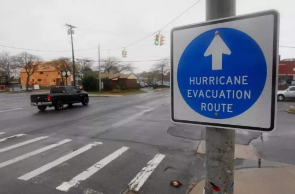
We are certainly seeing the impacts of Irene already today and there is more rain expected as the day continues. If you are concerned about power outages, National Grid has a site with an outage map. Local officials are suggesting you stay home to avoid the danger of downed trees, power lines, and flooding. Be safe! Email us your photos of damage – downed trees, flooding, etc. Many counties in our coverage area are under a Flash Flood Warning, a Flash Flood Watch, and the entire broadcast area is under a Tropical Storm Warning. Stay tuned to the radio and also download our app radioPup for your smartphone to keep up to date. Updated information after the jump.
UPDATED at 9:AM
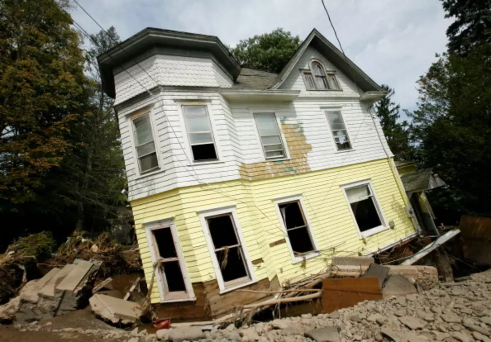
Irene is now officially a tropical storm, no longer a hurricane. The storm is currently passing over New York City and although we have already seen several inches of rain we will be seeing more as the storm continues. So far there is some flooding with more expected as the day continued. The Mohawk River and Hudson River won’t crest for a few days, however smaller rivers and streams will be impacted today. Schenectady County has thus far been the most impacted by power outages but they are widespread in the Albany area. North Greenbush and Colonie have both issues states of emergency and are suggesting no traveling. The Battenkill is expected to flood in Greenwich later today. The Schoharie Creek in Prattsville, and the Hoosic River in Eagle Bridge are also expected to flood by this evening.
More From Q 105.7


![Jumpin’ Jacks – The Popular Eatery in Scotia – is Underwater [VIDEO]](http://townsquare.media/site/79/files/2011/08/Jumpinjacks-flood.png?w=980&q=75)